Add These 9 San Francisco Bay Area Hiking Trails to Your Bucket List
In San Francisco, we are fortunate to not have to venture far to find a great park or an amazing trail. A quick drive in any direction will land you at one of the many national and state parks scattered across the Bay Area, with no shortage of potential “Sunday Funday” outdoor activities for hikers of any experience level.
We rounded up our nine favorite hiking trails in the San Francisco Bay Area to fuel your wanderlust. From short, coastal hikes to steep mountain climbs, get ready to blaze a trail through some of the most spectacular trails Mother Nature has to offer the Bay Area.
Where to Hike in San Francisco
Lands End Trail is a meandering scenic coastal trail boasting panoramic views of the Golden Gate and Marin Headlands from the edge of the continental United States — hence the name. The trail is mostly an unpaved, dirt trail, with a few steep hills and stairways between the Lands End Lookout to El Camino Del Mar in the affluent Sea Cliff Neighborhood. Be sure to check out the Sutro Bath Ruins at the Lands End Lookout Trailhead.
Difficulty: Easy
Distance: 1.5 Miles One-Way
Hiking Time: 30 Minutes to 1 Hour
Attractions: Shipwrecks, Eagle’s Point Labyrinth, Sutro Bath Ruins
Hiking Trails in the San Francisco Peninsula
Sweeney Ridge in San Bruno is a steady 600-foot hill with one steep climb leading to the ridgeline at the top of the mountain. Expect panoramic views of San Francisco, Pacifica, and Peninsula from the top of the ridge, making it well worth the hike. Sweeney Ridge is a great year-round trail, though fog may obstruct views.
Difficulty: Easy
Distance: 3 Miles One-Way
Hiking Time: 1 Hour and 15 Minutes
Attractions: Nike Missile Site, Portola Discovery Site, Wild Flowers
South City Sign Hill Park
If you’ve ever driven along Interstate 280 or flown into San Francisco International Airport, chances are you’ve noticed South San Francisco’s historic “SOUTH SAN FRANCISCO – THE INDUSTRIAL CITY” sign on the hillside of the San Bruno Mountains. Hikers can take a short out-and-back stroll or looped hike to the concrete letters and take in South City views.
Difficulty: Easy
Distance: 1.5 Miles One-Way
Hiking Time: 30 Minutes to 1 Hour
Attractions: South San Francisco Letters
Where to Hike in Marin County
Take a hike along the serene Mountain Home Trailhead to Muir Woods and soak in the majesty of the redwoods, which shade the trail. With a seemingly endless barrage of stairs, this trail is sure to be a great work out. Unfortunately, pets are not allowed in Muir Woods, and there is little to no cell phone reception in the park — plan your trip wisely. Parking is extremely limited, so arrive early and try to carpool if you’re visiting with a larger group.
Difficulty: Easy
Distance: 4.7 Mile Loop
Hiking Time: 3 Hours
Attractions: Redwoods, Wildlife
Cataract Falls Trail Loop is home to Marin County’s most popular waterfall — Cataract Falls — tucked away inside a wooded canyon. With elevation changes and steep, slippery steps, this trail presents some challenging obstacles; it also tends to be harsh when wet, so proceed with caution. Though the creek along the trail may be tempting to dip into, it feeds into a domestic water supply, so please keep yourself and your pets out of the water.
Difficulty: Moderate
Distance: 7.7 Mile Loop
Hiking Time: 4 to 5 Hours
Attractions: Waterfalls
An endurance test in its own right, the Palomarin Trailhead to Alamere Falls immerses hikers in nature with wildflowers and wildlife swarming — including Red-Tailed Hawks. Bring plenty of water, snacks, and a pair of binoculars to catch other aviary residents. Poison oak is found along the trail, so long pants are strongly encouraged. Dogs are not allowed on the trail.
Difficulty: Moderate – Hard
Distance: 3.75 Miles One-Way
Hiking Time: 2 Hours and 30 Minutes
Attractions: Alamere Falls, Views of the Farallones
Hit the Matt Davis Trailhead to Steep Ravine to embark on a truly magical journey to Mount Tamalpais’s summit from Stinson Beach. Prepare to trek past waterfalls and across wooden bridges, climb up ladders, and trail through an enchanted Californian landscape of towering redwoods, Douglas Firs, and oak trees. The rigor of this trail will vary depending on your physical abilities.
Difficulty: Moderate – Hard
Distance: 7.3 Mile Loop
Hiking Time: 4 Hours
Attractions: Waterfalls, Wooden Bridges, Famous Ladder
Where to Hike in the East Bay

Strawberry Canyon Fire Trail is a great place to watch the sunset over the Bay Area year-round. This pet-friendly trail in Berkeley offers hikers panoramic views, shade from trees along the trail, and challenging steep grade segments.
Difficulty: Moderate – Hard
Distance: 3.2 Miles One-Way
Hiking Time: 90 Minutes to 2 Hours
Attractions: Views of the Bay Area
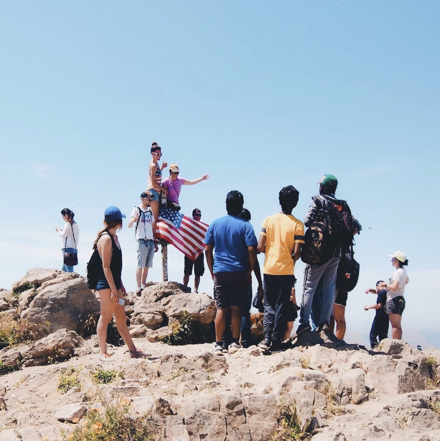
Mission Peak Regional Park draws hundreds of enthusiastic hikers every day who summit the daunting 2,000-foot Mission Peak to snap Insta-worthy photos with the “Mission Peeker” Summit Pole. With steep grade segments, dirt trails, and minimal shelter from nature’s elements, be sure to dress in layers, wear comfortable shoes, bring snacks, sunscreen, and plenty of water. The hike is best done during the Spring when it’s neither too hot nor too cold.
Difficulty: Moderate – Hard
Distance: 3 Miles One-Way
Hiking Time: 2 Hours
Attractions: Cows, “Mission Peeker” Summit Pole